
Florida Bay is located between the southern tip of mainland Florida and the Florida Keys. The Backcountry as it’s called consists of a triangular area generally north of the Intracoastal Waterway (ICW); south of the mainland and east of a line from Flamingo to Lower Matacumbe Key within the boundaries of Everglades National Park (ENP). It is a unique area of open water basins fringed by shoals and keys. To get from one basin to another one must cross a shoal or go through a pass.
Flamingo and the Backcountry were first settled by non-native people around 1885. The early settlers were plume hunters, charcoal burners, bootleggers, moonshiners, gator hunters, fugitives from the law and commercial fishermen. These same early settlers established the Backcountry routes and passes still used today. Hence we have such colorful place names as Snake Bight, Dildo Key and Crocodile Dragover. When ENP was established in 1947, the settlers relocated to Homestead and the Florida Keys proper.
The best thing about the Backcountry is its remoteness. Overpowered motorboats don’t venture outside the ICW. Jet skis are prohibited. A boating permit is required to enter ENP waters. I rarely see another boat there on weekdays, other than the occasional small fishing boat. This is not a place for a novice cruiser due to its remoteness.

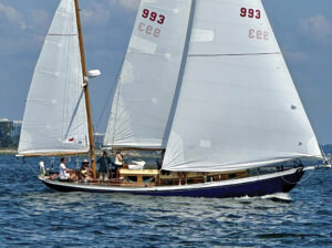
The right boat for Backcountry cruising must be shoal draft. This is no place for a fixed-keel sailboat. It is best to have a fully retractable centerboard and rudder. With everything up you should be able to float, but not necessarily navigate, in a foot of water. My boat, Egret, is a 26ft sloop I designed and built myself. Under power, she draws 13in. Other ideal boats might be a West Wight Potter, a Bay Hen 21 or a MacGregor 25D. With care, some of the popular swing-keel boats will do. The keel-up draft should be no more than two feet.
I navigate the old-fashioned way: dead reckoning with paper charts. I also have an electronic chart on my smartphone that I sometimes use with GPS to cross-check my position. However, my electronic chart does not include enough detail to find the passes. Place names on Google Maps also do not agree with place names on my chart. (I use, NOAA Chart No. 11451.)
Navigation is not easy in the Backcountry. The keys are all low and flat, making them hard to identify. There are usually no radio towers, buildings or navigation aids to help out either. Everglades National Park has its own unconventional way of marking the passes—with stakes. The stakes consist of 4×4 posts with pointers on top. In many places the stakes are on one side of the pass with pointers on top showing the direction of deep water.
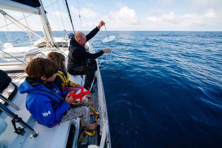
As I approach a pass, I start my motor. Unless I am on a broad reach or a run, I take my sails down. If you go through a pass on a beam reach or a beat and the centerboard grounds, the boat will stop. When you raise the centerboard, it will then slide to leeward before gathering way, which will only put you harder aground on the shoal. If I am not alone, I station a lookout on the cabin by the mast. In this position the lookout is next to the centerboard hoist and also in a good position to “read” the water. The lookout points out the stakes, which are sometimes bent over. Deep water is a clear light green color. Shallow water has patches of dark green and prop trails. Prop trails are light colored strips where a motorboat has denuded the bank vegetation. Prop trails can be seen clearly marking shoals on Google Maps satellite images.
I carry a push pole made from a 10ft length of PVC pipe with some cross fittings on one end. A push pole is standard equipment aboard Backcountry fishing boats. If you end up stuck on a shoal, it’s better to push off than power off with a motor. Pushing off is easier on both the bank vegetation and your prop.
If you are stuck on a shoal, one of your first thoughts will be, “Is the tide rising or falling?” This is not an easy question to answer. In short, it depends. If you are close to Flamingo, the tidal range is about 2ft. Close to Islamorada, it’s around 1ft, and close to Jew Fish Creek it’s 6in. Deep in the Backcountry there is almost no tide at all. Before setting out, it’s a good idea to download and print out tide tables for the time you will be cruising. Water levels are also influenced by the wind. The change can be as much as a foot. A strong southwesterly will raise the water level appreciably. A strong northeasterly will drop it.
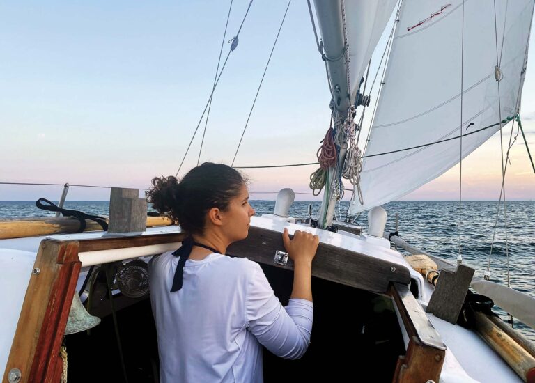
On a recent Backcountry cruise, my son Jim and I started out at Jew Fish Creek. An advantage to starting here is that you will better appreciate the peace and tranquility of the Backcountry proper after the chaos and mayhem of this popular waterway. Once you’ve left ICW marker 38 astern, the racket quickly fades.

Once underway we sailed to the Boogies on the west side of Blackwater Sound. The Boogies have several parallel creeks. We used West Boogie, which is wide and deep. Both ends of West Boogie are marked with stakes and “No Wake” signs. After a pleasant sail across open water, we anchored off the northwest side of North Nest Key. At first, we shared the anchorage with several motorboats, all there to enjoy the small sandy beaches, but they all left around sunset.
After a hearty meal of canned hash and bean salad, we turned in for the night and in the morning, headed for Pass Key Pass. After mistaking Lake Key Pass, which is closed, for Pass Key Pass, we continued on toward Eagle Key Pass, where it turned out that what we thought was Eagle Key Pass was in fact Pass Key Pass. (We actually made it all the way through before realizing our error!) This in turn threw off our dead reckoning, which made it impossible to find Crocodile Dragover. Jim eventually got a GPS fix, which put us back on track. After navigating our way through the long, intricate waterway that is Crocodile Dragover, we arrived at Dump Key Pass.
On previous cruises, Dump Key Pass had been well-marked. This time, though, there was nothing. I think the stakes may have been removed for replacement, in which case they are now hopefully back where they belong. Erring on the side of caution, we put Egret in full shoal-draft mode, with both the board and rudder up, and sailed over the shoals on a run.
Our next pass, Buoy Key Pass, was well-marked and easy to follow. From there the stakes west of Buoy Key continued west almost to Flamingo, where the Flamingo marina channel is marked with conventional red and green day markers. The marine itself was also all you could ever want, with good shelter, plenty of vacant slips, hot showers, dry ground to walk on and a small store.
After spending the night at Flamingo we continued west to Cape Sable before turning southeast to Islamorada, where we spent the night at Bayside Marina in Little Basin. This is a great marina with good restaurants nearby. After that, it was time to head back home, after another great little adventure. Best of all, as is forever the case when sailing the Florida Bay Backcountry area, there was also still plenty of exploring left to do. No sooner had we finished our trip than I was looking forward to coming back.
Photos by Jim Naumann
June 2021