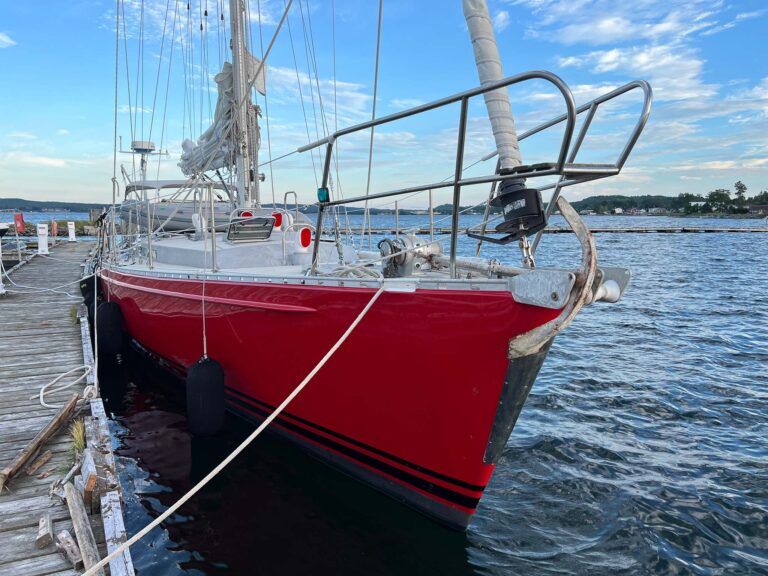
A weather forecast—like an old-school dead-reckoning plot—will decrease in certainty with the passage of time. Over the past five years of arranging offshore charters aboard our Swan 48, Isbjørn, and our Swan 59, Icebear, we’ve tempted the gods by consistently breaking the cardinal rule of cruising—sailing to a schedule. However, thanks to a fundamental understanding of big-picture weather patterns and a willingness to be flexible once underway, we’ve learned that even the toughest passages can be made comfortably. In this article, we’ll look at how we plan our passage calendar and the tools we use to forecast the weather. We’ll also analyze three difficult passages—Iceland to Ireland; a Bermuda-Azores Atlantic crossing; and a southbound migration from the Chesapeake Bay to the Eastern Caribbean—to see how these things all work in practice.

Besides the sailing itself, the neatest part of my job running offshore passages through our company, 59 North (59-north.com), is planning the next season’s calendar. I sit in the upstairs office of our farmhouse in Sweden, surrounded by books and charts, and open up Google Earth on my laptop. I literally have the whole world in front of me to plan the next 10,000 or so miles of our sailing calendar.
Many factors go into stringing these routes together. How much time do we need to leave between passages? Are we racing or cruising? What’s the customs situation in the countries we’re thinking of visiting? What’s the weather going to be like? Is it even safe to attempt a particular route at a particular time of year given the expected winds and chance of storms?
This kind of planning, when we’re picking out overall routes and seasons from the 30,000ft level, so to speak, represents the first stage of our weather-routing regimen. After that comes the second, passagemaking stage, when we pick our actual departure dates, head offshore and then react to the weather as it happens in real-time.
Climate: Weather Over Time
As an example, take our 2018 season up in the Arctic. The plan was to start in Sweden and chart a looping course around the Arctic Ocean, sailing to Scotland then up the coast of Norway to the Svalbard archipelago stretching from 74 degrees to 81 degrees north latitude. You can’t go north from Svalbard, so from there we’d turn south and sail 1,000 miles to Iceland before closing the loop in Ireland. After that we’d cross the Bay of Biscay to Portugal in anticipation of the following season’s trade-wind transatlantic crossing.
Weatherwise, we had several limiting factors, seasonal brackets, so to speak, within which to frame our plans. On the one hand, we had the Swedish winter: leave too early and it’s dark, cold and gnarly in the North Sea; we also didn’t want to arrive in Svalbard too early, as lingering sea ice and variable weather can make the already challenging sailing up there that much more difficult. On the other, we needed to get safely out of Iceland by mid-August to avoid the area’s fall gales. We also wanted to get across Biscay before the bad weather on that notorious stretch of ocean starts kicking in around October/November.
In the old days, I’d have consulted a pilot chart to look at the expected weather patterns for a given body of water in a given month, and then planned around that. But while pilot charts are still relevant (and awesome references to have around), nowadays we also have a number of other, more sophisticated tools we can choose from, tools that take into account more recent changes in the overall climate picture.
Jimmy Cornell’s latest iteration of his World Cruising Routes makes it clear it’s becoming harder and harder to place bounds on hurricane/cyclone season in many parts of the world due to climate change. In fact, it’s reached the point where in some places there are no longer any guaranteed “storm-free” times of year as there once were. As a result, the original pilot charts based on the past 300-400 years of data aren’t as relevant as they once were. Instead, we have to use data from the past, say, 15-20 years, to get a more realistic look at the average conditions in the more recent history.
With this in mind, we made sure to have the weather routers at WRI Inc. (Weather Routing Inc., wriwx.com) create a series of “climate studies” for the months of our planned Arctic trip based on the previous 20 or so years of data from the region, with the data broken up across each planned passage. Each of these sections was five to seven pages long and broken down into a number of sub-sections, including Synopsis of Weather Features, Tropics, Routing Options and Conclusions. Maps showing the typical weather patterns for the different areas where we planned to sail were included to give a graphical representation of what to expect. What we got was effectively a kind of super-detailed, almost real-time analysis of what Cornell does in his books.
As an example, the Biscay crossing “Climate-Derived Voyage Report” included the following:
Late August into early September is the best time of year to make this crossing. The gale and frontal tracks are located the farthest north, which minimizes the chances for seeing heavy weather for your transit. Wind angles are usually quite favorable for sailing, with winds in irons expected just 10 percent of the time, which minimizes the chances of motoring. If any remnant tropical cyclone is a concern, we would have plenty of time to plan for them—which could include delaying or pulling into a port prior to Lagos. However, these situations are relatively rare.
Bingo. We had our Biscay crossing window: late August to early September. From there we could work backward and plan the rest of the Arctic calendar.

Iceland to Ireland
Of course, when the time comes to actually set sail, the weather is going to be what it’s going to be, averages be damned. But with careful analysis in the present, you can still make the best of it.
WRI’s climate study for our Iceland-to-Ireland leg, for example, said mid-August would be a good time to make the passage. “Rarely will you see significant issues in August,” the report said. “This is the time of year when gale and frontal activity is at a minimum, before the onset of Autumn in September. Heavy weather is uncommon, and if you have a few days of flexibility, then departing well ahead of a front can help boost the chances of seeing favorable SW’ly winds.”
Unfortunately, sitting in the Vestmann Islands off Iceland’s southwestern tip, that average weather pattern was nowhere to be found. Instead, a series of lows, including the remnants of the season’s fourth named tropical storm, was forecast to cross our track, threatening to pin us down for several days to come.
“We anticipate SE’ly winds and swell to funnel and increase south of Iceland with winds of 25-30kts and swell up to 7-9ft,” the experts at WRI e-mailed as together we did our best to fine a window. “These E-SE winds will continue to funnel along the coast of Iceland for several days with 20-30kts and swell of 9-11ft.”
That night at dinner I told the crew, “Feel free to have a second beer tonight, we’re definitely not going anywhere tomorrow!” But then a few hours later, just when things looked their worst, a glimmer of hope. Studying the latest GRIB weather files over my morning coffee I noticed a subtle but important change in the forecast: in short, if we left later that day, we might just be able to squeak through a widening gap between a couple of the lows after which we would be spit out on the other side with following winds for the second half of the passage. A few of the crew had planned a mission ashore to hike a nearby peak overlooking the harbor and the town. However, I warned them, “Be mentally ready to go when you get back.” WRI concurred: “It is best to depart today near 1500 GMT,” they said, “in order to transit ahead of the merging gale southwest of Iceland and to allow the remnants of Tropical Storm Debby to pass to your south and east.”
Bingo again, as we nailed our weather window. Winds were calm as we left the harbor, and after a day or so meandering east on a light southeasterly, we tacked south and threaded the needle between the two lows. After that, we rode a brisk southwesterly all the way to Ireland. By carefully analyzing the route and staying flexible, we took a bleak situation and turned it into a great passage, never seeing more than 25 knots of true wind and never having it on the nose.

Transatlantic
We sailed our first transatlantic aboard Isbjørn in the spring of 2017 with the ARC Europe rally from Bermuda to the Azores. There is a small weather window for this passage as well, squeezed between the early-spring/late-winter gales and summer hurricane season, so May or June is the best time to go. The positioning of the Azores High dictates the route. Flip over Imray’s Chart 100 North Atlantic Ocean Passage Chart (Imray Nautical Charts & Books, imray.com), and you’ll find handy sailing directions created by the legendary Don Street himself on this and other routes. The classic route from Bermuda to Horta, which Street describes, traces the outer edge of the high, aiming north-northeast from Bermuda until you get up to 39 or 40 degrees north latitude, then east in generally southwest to westerly breezes. Sail too direct a route, and you risk transiting the windless center of the high, the “horse latitudes,” where you’d better have some extra fuel aboard.
Fair enough. The challenge with Street’s approach, though, is that it also sits just below the North Atlantic storm track. As lows that originate over the continental United States march across the ocean, they tend to track just north of the Azores high, and in May can sometimes have strong cold fronts associated with them bringing rough weather. The good news is that if you stay to the south of the centers of these lows, you can have following breezes the whole way—southwest winds at first, maybe some rain and squalls as the fronts overtakes you, then dry and sometimes strong west-northwesterly breezes following each front before the pattern repeated itself.
Of course, it’s one thing to recognize the pattern of low-pressure systems marching across the Atlantic. It’s another actually dealing with them at sea and maintaining a comfortable passage, which is where weather routing can make all the difference.
A few days after motoring out through Town Cut in Bermuda and aiming north-northeast, our first low—a strong one—looked ready to overtake us to the north. The GRIBs showed a classic pattern: an increasing southwesterly ahead of the cold front, then a quick windshift from southwest to west to northwest as the low moved off to the northeast, strong at first and then tailing off as the low moved further out of the picture.
The key was to time the passage of the cold front and anticipate the windshift. It was also important to think about the way the boat was set up. Sailing east-northeast in a southwesterly breeze meant we were sailing almost dead-downwind on starboard tack, with the mainsail prevented out to port and the genoa poled out to starboard. We knew the front would overtake us some time that night, and I wanted to be ready when it did, which meant changing from our downwind rig to one better suited to the changing conditions. I especially didn’t want to get caught with the mainsail on the wrong side of the boat if the wind were to suddenly swung into the northwest. We, therefore, took in the pole and jibed the boat onto port, with the mainsail (now down to the third reef) prevented out to starboard and both it and the genoa trimmed for a broad-reach as we sailed almost due north.
Sure enough, the front overtook us later that night. The skies darkened, rain showers passed overhead, and then, quite quickly, the wind swung from southwest to northwest. Because we already had the sails set up on port tack, though, all we had to do was simply follow the breeze, easing down to an easterly heading and continuing on our broad reach, now aiming straight for Horta.
Later that same night, after the wind had shifted into the northwest and was blowing hard, Isbjørn hit her top speed, 14.1 knots surfing down a swell. Now that’s what I call passagemaking!

The Snowbird Passage
The annual migration south from the U.S. Eastern Seaboard to the Caribbean is easily the toughest passage from a weather-routing perspective. On the one hand you’re squeezed between any late-season hurricanes that might be brewing in the tropics and any early-season nor’easters headed your way up north; on the other, you’ve need to get at least a three-day weather window to make your way comfortably (and safely) across the Gulf Stream. I’ve sailed this route a number of times, and for several years was also in charge of the Caribbean 1500 rally, basically helping make weather decisions for the entire fleet. This in turn meant having to make some tough calls on occasion.
Conventional wisdom says to cross the north-flowing Gulf Stream in a wind-with-the-current situation—a southwesterly breeze—so as to mitigate the sea state in what can be a particularly rough stretch of water in the wrong conditions. The problem is, as was the case with our transatlantic passage, a southwesterly in the fall often indicates an approaching cold front and its associated unstable weather. Once over the warm waters of the stream, squalls associated with these fronts can intensify far beyond whatever has otherwise been forecast.
For this reason, I like to get offshore immediately after a frontal passage when sailing this route, even though it means crossing the stream at the same time the wind is starting to veer into the north. Several years in a row we even abandoned the formal start time for the Caribbean 1500 and told boats to leave as soon as they were ready once the front cleared through. After a front, the wind will go west-northwest, sometimes blowing hard, as high pressure builds in from the west. Eventually, though—and timing is everything here—the wind will continue to veer into the north and then northeast. After that, if a ridge of high-pressure sets up offshore, it can continue to blow from the northeast for days—wind-against-current, and not good. The mission then is to cross the stream on that west-northwesterly as quickly as possible. Once on the other side, the wind can go northeast all it wants. You’re out of the current now, the crew has its sea legs, the ocean is warm, and you’re well on your way to the Caribbean.

We saw an especially gnarly version of this pattern in the 2016 Caribbean 1500, my last as event manager. To cope, My wife, Mia, and I ran the pre-start program in Portsmouth, Virginia, near the mouth of the Chesapeake Bay, and then promptly jumped aboard Isbjørn to join the rest of the fleet and get offshore as quickly as we could.
The start was smooth, but once offshore it blew hard from the west. Skies were clear, and the air was crisp, but the sailing was intense. Isbjørn flew downwind, wing-and-wing. In the Gulf Stream the wind was across rather than with the current, so it was a bumpy ride for the 60 miles or so we were there, but we avoided the notorious close-period breaking waves that can occur in a strong northeasterly. The start of the passage was a fast one, and before we knew it were in the warmer waters on the other side, aiming for Bermuda before we turned the corner and sailed due south in the building easterly trades.

The Big Picture
Weather forecasting and routing is fun, but it’s not always easy, and I’d be the first to admit we rely heavily on our friends at WRI for professional forecasting support and routing advice. That said, when the time comes to go to sea, they are not the ones on the boat, and I will often politely ignore their departure or routing recommendations if I like the weather I see and feel the boat and crew can handle it.
This past summer, I gave Jeremy Davis, a WRI forecaster for over 20 years, a taste of this kind of last-minute playing calling up in Newfoundland when he joined us on Icebear for the passage from Lunenburg Nova Scotia. Jeremy had been a lifelong weather forecaster but had never actually been to sea on a small sailboat.
Sitting in the tiny outpost village of Francois on Newfoundland’s rugged south coast, we prepped Icebear for departure on the final leg around Cape Race and up to St. John’s. The fog was dense, and the wind above the fjord was honking, a steady 30 knots gusting well over 40 as we found ourselves on the back side of a big low. Still, later that same day we deliberately sailed out into the gale for two very specific reasons. First, the wind, though strong, was aft of the beam and manageable. More importantly, the strong, dry westerly air would also clear out the fog by the time we reached Cape Race, making it much safer to navigate the iceberg-strewn waters on the approach to St. Johns.
Jeremy, of course, loved it, steering Icebear past the French outpost islands of St. Pierre and Miquelon in 10ft seas and slashing wind, finally getting to experience the weather he’d for so long been forecasting for sailors like us. He even had the chance to pose for a photo op in front of his first iceberg in the clear weather that came—just as expected.
Photos courtesy of Andy Schell and Mia Karlsson
March 2021


