
 Photo by Shutterstock
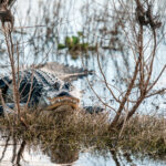
The chart showed 45ft of vertical clearance, and I knew the boat should be able to pass under the bridge. Still, there was that nagging voice in my head that wouldn’t let me be. “What if your air draft calculations were wrong?” it said. “And if you’re just a little too high the mast will come down on you like a telephone pole in a hurricane.” Fortunately, First Draft, my friend Richie Levine’s Catalina 25, put her shoulder down and sailed under the low bridge with several feet to spare. I exhaled in relief. Phew! What other challenges lay ahead?
Richie and I were partway through a voyage I’d long wanted to make: southbound on Florida’s St. Johns River, setting out from the Ortega River near Jacksonville and heading toward the end of the navigable water at Sanford, on Lake Monroe, 163 miles above the river’s mouth. I had been wanting to do this for years, as it promised to be a fascinating trip full of incredible scenery. I say promised because I had almost no advanced information about the upper river and knew no one who had ever been there. Adding to the mystery was the dearth of cruising guides for these waters. I wasn’t even sure if a sailboat with any kind of draft could make it to the end.
That was okay with me, though. A great part of sailing’s allure, after all, is traveling to exotic, hard-to-reach places that are off life’s beaten path.
 Photo by Shutterstock
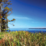
Of course, there’s a good reason why there is so little information about sailing the upper St. Johns: the bridges beyond Green Cove Springs, some 40 miles upriver from Jacksonville, rarely exceed a controlling height of 45ft, and most cruising sailboats, including mine, greatly exceed that. Luckily, after hearing how excited I was to go, my friend and fellow writer, Richie, volunteered First Draft, and we set a date for the journey in early February.
Since pre-colonial times the St. Johns River has been about transportation. It’s a wide and slow-moving stream—more than 300 miles long and up to three miles wide in places—that bisects the state and earned it the name Welaka, or “river of lakes” by the Timucua Indians. Until the creation of the railroads the river was the primary means to travel, transport goods to market and deliver mail. As people headed inland to develop farms and cattle ranches, towns sprang up along the riverbank, supplied by regular visits from steamboats.
The entire serpentine route to Lake Monroe is dredged by the Army Corps of Engineers, with channel markers maintained by the Coast Guard. To find our way, we used old-fashioned paper charts and the Polaris Navigation GPS app on Richie’s smartphone. It was nothing fancy, just an electronic version of some seamless NOAA raster charts with an avatar of our boat projected on it.
On a river, there’s nothing like a steady breeze aft of the beam and a current going your way. And for that entire first day, the wind blew cold from the northeast and carried us on a broad reach until well past sunset when we rounded a winking green nav aid and turned into Solano Cove, 29 miles closer to our objective.
Day two began with an excellent omen as the moon, Saturn, Venus and Jupiter all lined up in the eastern sky and pointed the way south. Then the clouds moved in, it began to rain and the outboard refused to fire up. (So much for good omens.) Putting our heads together, though, we tracked the problem down to a loose fuel hose and were underway at 0830 for a day of motorsailing in a light breeze, making 6 knots with some help from the tide.
 Photo by Robert Beringer
As we did so, the river’s appearance altered with every passing mile until we could scarcely recognize it. Swamps and marshes lay at every turn: long undeveloped stretches flanked by dense forests of moss-covered live oaks and the buttressed trunks of stately cypress trees—the same view that William Bartram had experienced when he explored the river in 1774. Tawny water also hid the many manatees, who only revealed themselves through plumes of water as they pumped their flappers like Olympic swimmers. Despite the mild weather and good soundings, we didn’t cross paths with a single sailboat the entire voyage.
At one point the river split, and we almost made a wrong turn into the entrance of the ill-fated Cross Florida Barge Canal, which business interests and environmentalists battled over for 40 years before it was finally killed for good in 1971. It now serves as an access point to Rodman Reservoir, a popular fishing spot.
Near Georgetown, we watched one of the shortest ferry rides in America as a small boat and barge made the 100-yard crossing from Drayton Island. As the day ran out of light we pulled into a cove near the village, set the hook and called it quits.
Next morning, on Groundhog Day, Lake George, the second biggest lake in Florida, spread out before us, wide, shallow and almost 10 miles across. The nav aids there are also miles apart and there are no distinguishing landmarks, making it easy to get lost, so it’s best to follow a compass course. But for a few eagles and ospreys, we made the crossing alone.
All around us, free-floating mats of invasive water hyacinth dotted the water. Native to the Amazon River, this prohibited aquatic plant was introduced in 1890 by an admirer who loved its attractive purple flowers and wanted to “beautify” the St. Johns. Bad idea: within a few years its prolific growth had completely clogged sections of the river, and it has since spread to 33 other states. Millions have been spent trying to control it using pesticides and mechanical harvesting. Hard to believe that if left unchecked this “lovely plague” would quickly cover the entire lake and upper river, making navigation impossible.
Exiting Lake George, the river was now all freshwater and the current all against us. No sailing here, as the turns were sharp and frequent. We also took care to be ready for evasive action should a tug or fast fishing boat appear around a bend.
 Map by Pip Hurn
Using the latitude markings on the chart, I estimated we had about 25 more miles until we’d reach the end in Sanford, then, Oh no! Before I could stop him Richie called his daughter and made dinner plans, as I silently cringed. The Sailing Gods would surely punish us for this hubris. Sure enough, near Blue Spring State Park we wandered a little too far to one side and wham! First Draft slammed into a mudbank. Fortunately, a kind group of strangers aboard a large pontoon boat took our line and pulled us from the bank, and we were soon on our way.
As the sun dipped and myriad birds came to roost in the mangroves we made out a gauntlet of manmade impediments up ahead in the fading light: a train bridge, US17 and two 45ft I-4 highway bridges, all in quick succession. Drawing closer, the train bridge proved to be only halfway up and had the appearance of a longterm repair, so that it looked like the end of the road. Fortunately, the tender was on duty and promptly raised the single span. We passed under the trio of clamorous highways and entered an inky-dark Lake Monroe as our objective hove into view.
Alas, it was now that Richie and I discovered just how poor our night vision truly is. In the shoal-filled lake with its few lighted markers, we crept from triangle to square, Richie’s face buried in his app as I squinted into the darkness. Somehow we remained in the channel, as we made our approach to the now darkened Monroe Harbor marina. We touched once, twice, three times, argh! but still managed to get around the pier and into the channel for the marina.
Finally, there came one last test: a darkened five-story building moved swiftly in our direction, taking up the entire channel. It made no sense that it was there, and we stared up at the leviathan, completely disoriented, incredulous. I had a hunch and grabbed a flashlight, jumped up on deck and shone it on our mast and bow. Presently a spotlight like that of a police helicopter came beaming down, and we heard…music! Passing close to port we now spied the sternwheeler Barbara-Lee, heading out for an early-evening dinner-dance cruise.
Deep breath. It took a few minutes for my nerves to calm, and then we slid into a transient slip and headed over to the steak and seafood place for some well-deserved shore leave.
If You Go
A free navigational website of the St. Johns River with marinas, fuel, repairs, restaurants and anchorages: waterwayguide.com/explorer
Polaris Navigation GPS available free at Play.google.com (does not require wifi connection)
South of Palatka facilities on the St. Johns for food, fuel and repair are scarce, self-reliance is paramount.
September 2019


