After hurricane Irma bashed through Florida and the southeastern coast of Georgia and South Carolina, significant damage to infrastructure has been reported. Damage to marinas and other facilities is relatively easy to see and report. There are several resources to track the damaged marinas. Waterway Guide provides a list of marinas open and or damaged (https://www.waterwayguide.com/hurricane-status-updates). Salty Southeast Cruisers Net, is another good resource for facilities’ updates. (http://cruisersnet.net/marina-conditions-and-updates).
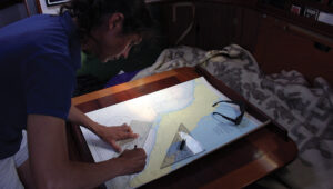
The damage to navigation aids is more difficult to observe and more complicated to record. The remains of the damaged structures may be in place, providing at least a frame of reference as you look down your course. Navigation aids which are destroyed and or a pushed off station will be much harder to identify. There is no easy solution for tracking this. The US Coast Guard Notice to Mariners is very quick to report discrepancies in list form. After the recent storms, there are hundreds, if not thousands of damaged and missing navigation aids.
In the aftermath of Hurricane Matthew in 2016 the US Coast Guard was very efficient at repairing and relocating the navigation aids. Along many stretches of the ICW, the damaged aids were repaired or replaced within two weeks or a month, we can hope for similar action this year. NOAA was updating their charts punctually in 2016. This year the number of damaged aids is greater. Boats headed south will have to rely on each other and on other sources for updated information. One popular reporting system is Active Captain, the crowdsourced cruising guide. The local tow boat operators along the ICW are probably your best source of up to date information. A call one day ahead to your towing provider at each of major inlet crossings should be a part of your daily planning.
Heading south in the fall of 2017 there will be some challenges, but there was a great deal of dredging performed in NC during the spring of this year and the ICW is probably in better shape than it has been in for several years. Monitor the storm damage reports. Update your charts frequently along the way, and call several days ahead if you are looking for a marina transient slip. SAIL will present additional ICW updates at the SAIL Sailing South Seminar in Annapolis.
SAIL Magazine is monitoring conditions along the ICW. So far we have limited information on the conditions. We will continue to monitor and report. ICW Update Lockwoods Folly AICW Stm. 321 Update Due to reports of shoaling the US Army Corps of Engineers has surveyed the ICW in the historical trouble prone section. This was dredged in the Spring of 2017 and has already filled in following Irma. Below are the USACE survey and waypoints. Also included are the waypoints displayed on NOAA chart 11534 which was updated though LNTM this week. The buoys show in the USACE survey and on the NOAA Chart have not yet been moved to reflect the changed bathymetry. Watch for this update in the next week or two.


There are sure to be additional changes and updates to the ICW over the next few weeks. We will share the most recent information available at the SAIL Sailing South Seminar in Annapolis on October 8. Even more up to date information will be available at the Hampton Snowbird Rendezvous October 12-15.
September 2017