
The way that sailors now can get corrected, printed-out charts from the federal government is causing some frustration, with the National Oceanic and Atmospheric Administration saying the next big fix for the system won’t happen until November.
This past December saw a full transition to the NOAA Custom Chart (NCC) program for providing paper charts for U.S. waters. Instead of recreational boaters being able to order an updated paper chart by number—say, NOAA Chart 13230 for Buzzards Bay, Massachusetts—the NCC program now creates paper charts from the agency’s Electronic Nautical Chart database. This method satisfies regulations for larger ships, while sailors who want corrected, printed-out charts have to click to define an area, and then print out a chart based on their request.
There don’t seem to be major concerns with using these NCC charts on multifunction displays where sailors can zoom in and click to see details, but with printouts that show a broader view of an area, the way the charts are being made is causing problems.
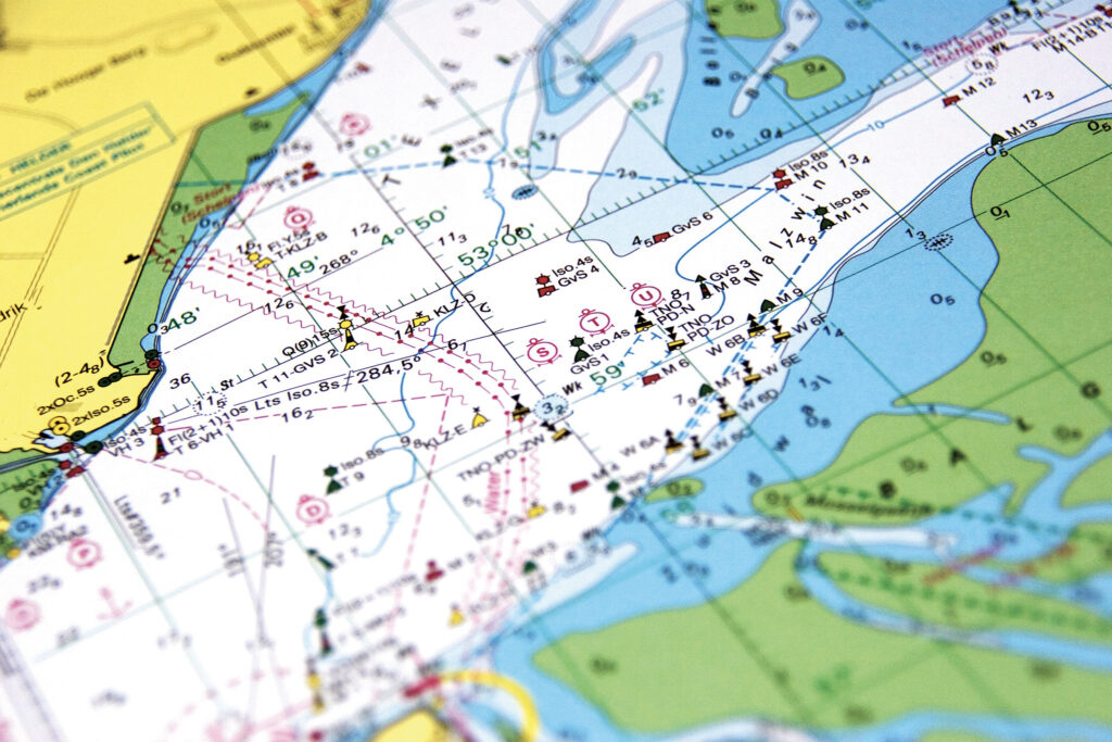
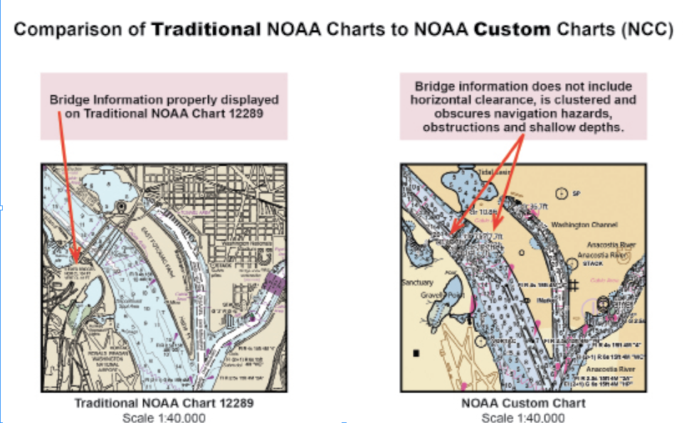
“They do have NOAA symbols on them, like the buoy symbols, so that’s good. And it has, from 2 feet away, the look and feel of a NOAA chart, which is also good. It’s all the same colors as a NOAA chart for the land, the marshes, all of that,” says Lee Estes, owner and president of Maptech. “Where the wheels start to come off the wagon is when you create a chart from the NCC, it has problems displaying chart information—and sometimes it’s a lot, depending on the chart you’re making.”
In the past, these were handled by a human who would think about the best way to present information on a chart, doing things like twisting a label sideways so it doesn’t overlay on top of something else. But the way this NOAA program works, information like bridge heights is sometimes being printed on top of other information, or in other ways that make it impossible to read.
“A human being with traditional charts would say, let’s put this label here and rotate it here and make sure nothing is covering it up so you could understand it,” Estes says. “This program just takes the bridge information and throws it on top of everything. You can’t read anything but the top one, and that’s hard to read because of all the other stuff.”
Julia Powell, chief of the marine chart division at NOAA, says the agency is aware of the problems in printed-out versions of the NCC charts. The agency is working to correct these problems, she says, but boaters are not likely to see any major changes until the next major software release happens in November.
“We are aware of those labeling issues, and we are actively engaged with our software vendor who produces the engine on fixing those engines,” Powell says. “I have had countless phone calls with them.”
Powell adds that most of the complaints NOAA is receiving are not from recreational boaters, who often rely on multifunction displays where the NCC charts allow skippers to zoom in, but instead from companies that use NOAA charts to make things like printed-out, spiral-bound chart books.
“One of the reasons why NOAA opted to disband its traditional paper chart program is that we had sales figures,” she says. The number of people purchasing paper charts “really was a very small bit of the market, whereas the electronic navigational chart is just really that primary market.”
Maptech is one of those companies that’s having problems, Estes says. From his perspective, there are no issues with sailors using electronic charts in general, but when they eventually want updated printed-out versions, they may be frustrated about what it takes to get them. For instance, he says, companies like his will need to take more time to publish new editions while making all kinds of corrections.
“Not too many people have noticed this because not too many people have used a custom chart yet,” Estes says. “We, on the other hand, are looking at this much closer than the average person because we want to use this to correct our charts going forward, and we don’t want to find out after we print 5,000 books that people can’t read any of this information.”
Estes says NOAA should make fixing the problems more of a priority since this system is now the only way to get corrected charts from the government.
“I would like some urgency in getting this corrected,” he says. “If people go to this government-sanctioned place to get government-sanctioned information, it’s not right. They owe us correct data that’s displayed correctly.”
Powell says that right now, the technology is not where NOAA wants it to be either, but the agency is continuing to work with its software vendor while also making improvements internally.
“Unfortunately, it’s never going to be like the old handwork, but we are trying to get it to where it is an acceptable solution,” Powell says. “We continue to focus in on that, and we hope with the next big software release, that once we implement that, we should have significant improvement on navigation labeling sometime in November.”

May 2025


-hero")


