North America is as big as its waters are varied. Some sailors inhabit a tideless world where 0400 departures to catch the south-going stream through Hell Gate are as foreign as flying to the moon. For many of us, however, tidal currents can make or break a trip, and it needn’t be the monstrous 5 knots that New York’s East River can shove our way. Two knot currents are common in many locations, typified by parts of Long Island Sound or the Golden Gate. To state what might appear obvious, a yacht motoring at 6 knots is slowed to 4 knots by a foul current flowing at even this modest rate. Time it right with the same stream underneath, and you’re rattling over the ground at an improbable 8 nautical miles in an hour. Beating to windward, things get even more interesting.
A yacht sailing 6 knots on a reach typically makes little better than 5 knots close-hauled with a bit of a sea running, whatever misinformation its magic dials might be putting out. Beating at 5 knots, the same boat’s velocity made good (VMG) to windward will be a little over 3 knots after leeway has been accounted for. Take a couple of knots of stream running dead downwind off that, and you’re not getting home in time for breakfast. Add 2 knots of fair tide, however, and you’re back up to speed again. The guy who took the trouble to do his sums is making a good 5 nautical miles every hour, while the poor sap who didn’t bother is creeping along at one. Most likely, he’s already started his engine.
Dealing with the current running from ahead or astern, as often happens on coastal passages, is simply a matter of consulting tide tables, then adding or subtracting the numbers. Piloting across the tide is more challenging. In sight of the shore, however, it’s simple once you know how.
What’s Happening When?
The books are full of tide tables. In many cases, however, the best way of finding out which way the tide is running is to look over the side. Moored in a river, you can’t miss it sliding past the boat. Farther out, you can often eyeball it moving against buoys or pilings. Published materials are only predictions. They are generally pretty sound, but when the tide is close to turning, it’s far more accurate to see for yourself. When you’re offshore, however, or planning a future passage, you’ll need to rely on data from tables.
Current Tables
The primary sources for these are either locally produced tables or publications such as Eldridge’s Tide and Pilot Book. The illustration below is a section cut from the page of an almanac and shows how tides are usually presented. The data are for the current on a specific day in a given year. Streams shown are the maximum for that tide. The current directions live at the top of the page. They are usually described in true degrees, not magnetic. For this station, slack water is also given. If it isn’t, it’s generally safe to take slack water as being halfway between the two maximum figures showing opposite streams, because tides generally deliver two highs and two lows each day. This means the current reverses every six hours or so. It starts out slack, then builds up steadily to the value shown, before dying away to zero once more.
In the absence of any further particulars, intermediate rates are worked out by dividing the maximum stream by three. At the end of the first hour after slack, the rate will be one-third the maximum. At the second hour’s end, two-thirds, then it’s up to the full whack for an hour either side of the published figure, and so on down again.
Currents on the Chart
When all else fails, take a second glance at your navigation chart in places where current seems likely. At pinch points, arrows will often indicate the current direction, with the speed at ebb and flood noted alongside.
Piloting with Tidal Currents
Sailing in San Francisco Bay with a group of instructors a few years back, I was interested to hear how they taught cross-tide tracking. A number of ideas for handling the sideways slide in relatively confined waters came up, but the only one worth noting concerned the use of ranges. Approaching an inlet from seaward, the authorities are often kind enough to erect a couple of range marks that keep you on a dead straight track through whatever dangers lurk along the way as long as you keep them in line. The idea of staying on course using what Europeans call a “transit” of two objects is fundamental to sailing in a cross-current. Most of the time a charted range isn’t available, but that doesn’t mean you can’t invent one of your own. All that’s necessary is to visually identify something ahead where you’re going – perhaps a pier head or the next mark on a racing course – and line it up with something stationary behind it. This can be anything at all, and it needn’t be on the chart. It may be a church steeple. It could be the striped awning of Mac’s Clam Shack, or a cow lying in a field chewing its cud. So long as your chosen objects stay put, and you and they are all on a range, you’re tracking in a straight line over the sea bottom.
So far, so good, but what if there’s no background to line things up against? Unless you’re relying totally on electronics, this is where the chartwork starts, and all I can say is, thank heavens the whole thing is easier than some navigators like to make it look.
The One-Hour Vector Diagram
Our plan is to sail from just east of Cerberus Shoal buoy to the safe-water mark at Fisher’s Island Sound (Figure 1). Notice the various lines, A, B and C. Here’s how they work:
Start out by plotting a line A joining where you are with your destination. This is the ground track we want to follow. For clarity, I’ve given it two arrowheads. U.S. convention doesn’t use arrowheads, although U.S. Sailing has adopted this European idea, because it is much clearer. If you don’t like it, leave it out. No problem. This line is around 7 miles long. Running it will take a bit over an hour, so for a typical sailboat, if we allow one hour of tide, we won’t go far wrong.
Next plot a line B to describe what you believe the current will do over the coming hour. Ideally, this information will be found in a tidal atlas. Failing that, you may have to make an intelligent guess from current data given for neighboring locations. Today, for this hour, our best estimate is that the tidal will be running 1.2 knots to the east-northeast, so we’ve plotted the line in that direction, 1.2 miles long, and given it three arrows.
Now let’s assume that instead of sailing away from our start point, we just sit there and let the current have its wicked way with us. After an hour, we’d end up at the outer limit of line B. If we then were able to switch off the current and we opted to sail for an hour, ending up back on track, we’d plot line C. For it to work properly, it must be the exact distance we expect to travel in one hour—the same time as the tide was acting on us. We therefore open the dividers to one hour’s run—say 5.5 miles—put one point on the end of B and the other wherever it lands on A. Plot a line C joining these two marks and, in the fantasy world of “current on, current off,” we’d be right where we want to be. The line is called the “course to steer.” In our convention, we’re giving it a single arrowhead.
Because the current doesn’t really switch on and off at our command, we actually steer the course indicated by line C right from the outset. The result is that we stay on ground track A, crabbing along it as though we’re following a range.
You’ll notice that C doesn’t end up exactly at our destination. This is because we’ve made it one hour long. If the trip had been shorter, C might well have extended beyond the destination buoy. If so, we’d have extrapolated line A to complete the picture. It wouldn’t have altered the course by a single degree. However, if we’d made the classic blunder of joining the end of the tide line to the red and white buoy, we’d have rendered the diagram spurious, because the length of C would then have been arbitrary. To succeed, all the lengths of these lines, or “vectors,” must equal their speed equivalent.
Inexperienced pilots sometimes look at the distance to travel, determine their likely speed, then start dividing the trip up to find exactly how long it will take. They then apply this factor to the tide and multiply or divide accordingly, so they can join the end of the tide vector to the destination. This can never work, unless some sort of calculus is deployed, because as soon as tide is applied to the course, the actual distance to sail through the water changes. So don’t even be tempted to stray down this horrible route.
Remember that perfect results depend on accurate tidal data. Unfortunately, this won’t happen. Wind and air pressure can play havoc with tide predictions. In any case, data are given for survey stations. You’re sailing across a stretch of water, not sitting on the chosen spot. A certain amount of intuition helps, and when you’re nearly there you can often spot the buoy and line it up with some suitable object behind it, which is far more accurate than number crunching. The bottom line is if you can’t see your destination and there’s a cross-current running, plotting a vector diagram is the best non-electronic solution in an imperfect world.
Course to steer over more than a single hour
Occasionally, a route will track across a current for more than one hour (Figure 2). The current will be changing, so the question arises as to how to deal with this. The answer is not to plot a new course each hour, but to input all anticipated tide vectors up front, then work up the course to steer with a length that coincides with how ever many hours of tide you’ve plotted. If the stream changes direction halfway through the passage, this system will account for it and will ensure you don’t sail farther than necessary. If you opt to stay on track all the time, you’ll have to work harder, because you’ll be fighting the tide. Go with the flow instead. Let it take you off-track, then bring you back again. You’ll end up plotting a smaller tidal offset and the result will be a faster, safer passage.
In the illustration, the lefthand diagram shows what happens when a boat tries to stay on track. By allowing herself to be drifted, as in the righthand diagram, she sails a greater distance in the same amount of time.
Electronic Current Solutions
Accounting for tidal current electronically is a breeze, so long as your equipment is set up properly and you’re asking the right questions.
GPS and paper chart: This one is easy with a decent GPS receiver. Plot a waypoint at your destination and hit the ‘GoTo’ button. Steer so the GPS readout of your track, or COG (course over ground), is the same as the bearing to the waypoint, and you’ve cracked the problem. The computer does the rest. Don’t forget to make sure you aren’t being sent over a large rock. The GPS doesn’t know where they are.
Electronic Chartplotter: A well setup chartplotter provides the best of all solutions to a short cross-current passage. To enjoy the full benefit, you must first switch on the “track,” or COG vector. This is often confused with the “heading” vector, and many plotters add to the fun by making “heading” easier to find and more conspicuous on the screen. My own expensive plotter dishes up a weak green color for ground track and a meaty black line for heading. I can’t alter these, which tells me something about the manufacturer. Heading is rarely as useful as track, because it doesn’t show where you’re going. It only indicates which way your bow is pointing.
With the track vector emanating from the bow of the little boat on the screen, you’ve only to steer so the line intersects the destination and the job is done.
Electronic Caveat
On a cross-tide run with a one-way current, electronics are great. But if the current is likely to reverse, electronics can drop us straight into the classic error of the pilot who lays off a single course for each hour of tide so as to stay on the rhumbline. Most plotters can only keep you on the line, they can’t be programmed to let you drift with the tide then come back again. Only you and a piece of paper (or a PC-based chart program) can do that. Follow the plotter slavishly with a reversing current and I guarantee you’ll be the last one home!
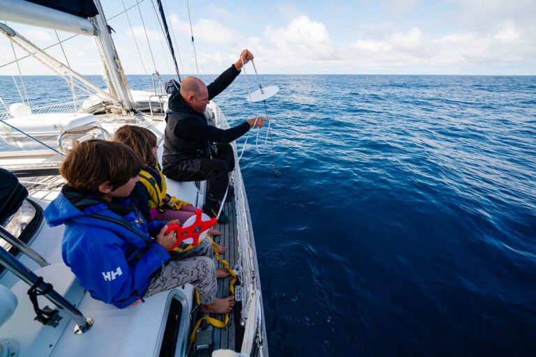
Top photo by Peter Nielsen