
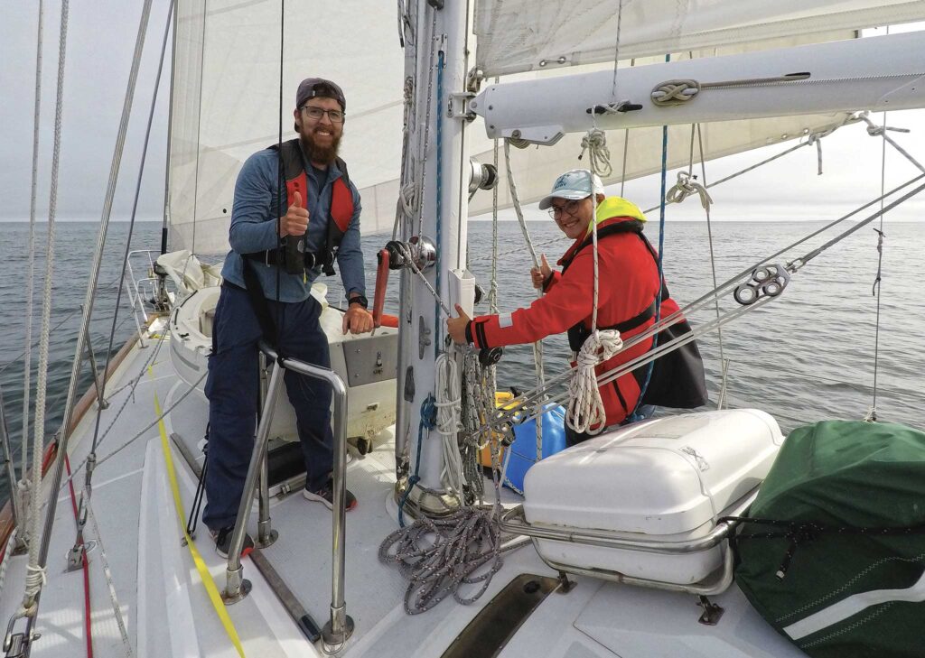
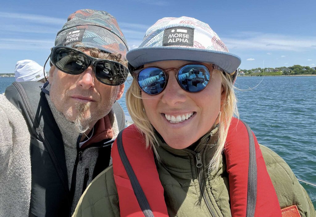
The whale erupted from the water, splashing close enough to leave us breathless. Our students grabbed their cameras in a frenzy. For most, this was their first offshore passage. They had signed aboard with Morse Alpha Expeditions for the week, to gain experience and boost their sailing confidence. My co-instructor Tara and I smiled as we kept an eye on the surface for another breach.
From the awe of encountering one of the largest animals in the sea to the practical challenges of navigating the strong currents in Cape Cod Canal, we would face it all—standing watch under the stars, timing our approach with the tides—all in a passage that felt both familiar and reminded us how extraordinary the ocean can be.
The helmsman turned Rocinante, our Norseman 447, slowly to starboard, forgetting about the compass, for a moment. It was just us and the whale. There was no land ahead or behind us for reference anymore. We had begun our sail from Newport, Rhode Island. By now, we were already well on our way to Maine, and had lost sight of Cape Cod miles before. We waited idle, letting the sails go limp for another few minutes, silently watching for the whale to surface again. When we were sure it had moved on, we decided to continue on our passage.
Our route began in Newport, Rhode Island, bound for the Cape Cod Canal, in the northeast corner of Buzzards Bay. From above, Cape Cod looks like an elf’s boot that juts into the ocean. The canal acts as a shortcut through the peninsula. Once on the other side, the direct sail to Penobscot Bay, Maine, is 130 nautical miles of open water, exposed to the vast Atlantic to the east. It can take two days and one night, culminating in a landing on Maine’s rugged coast, with lobster boats, hidden rocks, and sometimes fog. This is the perfect passage for someone familiar with sailing but ready to try the next level: challenging coastal navigation and a taste of the offshore experience. It is ideal for a Morse Alpha training expedition—because we can pack a lot of learning and experiences into a short amount of time.
Two days earlier, our final pre-departure weather check showed a quick moving cold front approaching. It would bring gusty northeast winds for 12 hours before returning to the typical summer southwesterlies. We knew our timing was going to be tight. The old rule “never sail to a schedule” is always on our mind, even as we defy it by setting our departure and landfall date a year in advance. Despite the contradiction, in the twelve years of running Morse Alpha Expeditions—knock on wood—we’ve never been late.
We planned the expeditions in three legs:
Leg 1: Newport – Cape Code Canal
Leg 2: Cape Cod Canal and Massachusetts Bay
Leg 3: Cape Cod – Penobscot Bay
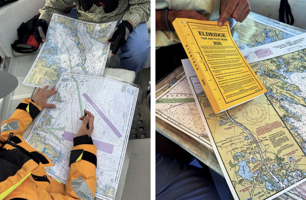
The crew-in-training split themselves into teams and made independent plans for the entire journey. All teams realized that prioritizing the favorable currents through Buzzards Bay, The Cape Cod Canal, and if possible, the entrance to Penobscot Bay will make for a smoother passage. They coordinated wind forecasts along with tide and current predictions from Eldridge Tide and Pilot Book. Eldridge is an essential resource for the North East sailor. It contains tide information for the entire East Coast. Particularly useful are the current diagrams for all the tricky spots, like Hell Gate, The Race, Vineyard Sound, Cape Cod Canal, and Buzzards Bay, where the water is squirrely and the tide and current aren’t as intuitive as you might expect.
After reviewing each team’s proposal, everyone agreed on a consolidated plan that took a few elements from each team. This decision-making process is just one way we establish a shared mental model—the key ingredient to a successful passage.
Leg 1:
We slipped the mooring lines in the middle of the night to catch the favorable current through Buzzards Bay ahead of the forecasted Northeasterlies. Rousing the crew from their short sleep was easy. It was the first day of our big-little adventure, something we’ve been anticipating for months.
Newport is a busy harbor, and departing at this hour in the high season was akin to playing Frogger in the dark. That’s why we started the passage with all hands on deck—more eyes for spotting ships and small craft in the night. Conveniently, there was a superyacht with lights aglow, illuminating the anchored boats that stretched outward from the mooring field three or four rows deep.
As we came around Castle Hill, the southern tip of Newport Harbor, the bow started bouncing in the ocean waves. Here, the Atlantic ocean meets the entrance to Narragansett Bay, and when the wind is blowing from the south, it’s quite often a “wet kiss”—where wind opposes waves. Rounding Brenton Reef, we made a course for Buzzards Bay. With wind and seas on the quarter, the motion was more pleasant. We set the mains’l and jib, and started making miles toward the Cape Cod canal.
The conspicuous Buzzards Bay Entrance Light structure was already in sight. At first glance, sailing up Buzzards Bay can seem simple. Shoot for the middle, and with flashing red navigational buoys on the right, greens on the left, it would seem like a maritime runway. But it wasn’t. What we saw was as colorful and varied as a Christmas tree. We had to figure out which buoys lined the main channel, and which ones were for secondary channels.
By now, we had switched to watch rotations, so we were down to just three sailors on deck. Each took a look through the binoculars to try and determine which light was which, and correlate it to the chart. “Why can’t we just follow a chart plotter?” They asked—a question we often encounter.
Since our expeditions focus on learning and developing the whole sailor, we typically stick with traditional navigation for at least the first half of the journey. Not only because of the common argument that knowing traditional navigation serves as a vital backup to GPS, but because learning to navigate this way fosters a level of engagement that a chart plotter can never match. It also quickly enhances the sailor’s situational awareness—considering weather, other boats, currents, and landmarks—not just navigation.
One by one, we determined which flashing light ahead was the next one on the “runway.” First it was the two and a half-second pair, then the four-second green flasher. When it was at 316 degrees, we altered course 20 degrees to the right. All of this was laid out in our prepared “light list” to check off as we passed each one.
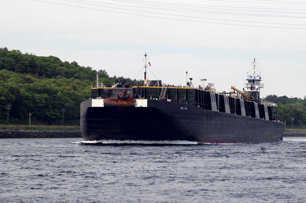
“Some of the buoys are moving,” I overheard while below conducting a routine boat check. “And they’re not flashing, but we’re heading right between them both, so we should be good.” I popped on deck quickly to discuss these moving buoys. Interpreting what you see in the dark is difficult. I suggested we check the AIS. On the screen we observed a vessel three miles ahead on a reciprocal course, moving at 9 knots. It was named Sapphire Coast. This made sense, we could now see the flashing yellow light on the front of the barge, the tell tale sign of an ATB (Articulated Tug Barge) which is a tugboat pushing a rigidly connected barge. Buzzards Bay is a busy waterway for commercial traffic running between Boston and New York. Most of the commercial traffic is tugboats pushing or towing barges.
We altered course to starboard to show the ATB Sapphire Coast our port sidelight. We hailed them on VHF channel 13, the designated “bridge to bridge” channel, used by commercial vessels to coordinate maneuvers and passing.
“Good morning Cap, we’re the sailing vessel ahead of you, bound for the canal, we’ll pass port to port, over,” we said.
“Roger, one-whistle, thanks for the call, have a good trip.”
It’s a short conversation that alleviates any doubt, clarifies intentions, and confirms we’re aware of one another.
The sky was beginning to show a hint of pink, and it was almost time to wake the next watch. A boat check, completing all the above and below decks tasks on the checklist, a log entry, a proper watch transfer, and the three of us would soon be in bed.
Every time I climb into my bunk after watch, the song Enter Sandman from Metallica plays in my head: “sleep with one eye open, gripping your pillow tight.” But on this morning, with trust in my mate, the crew, and our safety routines and protocols, I could allow the gentle ocean swell to rock me to sleep with both eyes closed.
Although the next favorable current through the canal began in just an hour, we decided to anchor on the south side of the canal to wait out the strong winds in a safe anchorage. Tucking in as far as we could between Wings Neck and Scraggy Neck on the eastern side of Buzzards Bay allowed us to reduce fetch and find a shallow 15-foot anchorage. This set us up well for a comfortable night in the 25-knot winds.
Leg 2:
Motoring out of the harbor, the next morning we immediately felt the results of last night’s blow; the waves had built to at least three feet with a very short period. Our decks were awash as we motored slowly towards the canal channel entrance.
From end to end, the transit is 12 miles, though the canal itself is seven miles long at 480 feet wide and 32 feet deep.
If you’re heading through the canal, make sure you’re up to speed—literally. The Eldridge Tide and Pilot Book has all the nitty-gritty details, but here’s the quick rundown: First off, keep your speed under 10 knots. If you’re cruising with the current, you’re the stand-on vessel.
You’ll need to duck under a bridge with a clearance of 135 feet, which isn’t an issue for most recreational vessels. There is, however, a lifting bridge that lowers for the train a few times per day. If it is down, you will have to wait for the train to pass and the bridge to rise. If your vessel is 65 feet or longer, don’t forget to check in with Canal Control for clearance. For those anticipating a slow transit, if you can’t make it through in under two and a half hours, you’ll need tug assistance. Begin your communication with Canal Control on VHF channel 13 and keep that radio active throughout your passage.
Lastly, a heads-up: jet skis, seaplanes, paddle-driven craft, and sailing vessels without power are not allowed in the canal, so keep your jib furled, engine on, and enjoy the ride!
Passing Massachusetts Maritime Academy to port, we hitched a ride on a strong, favorable current, and our speed increased to 9 knots, marking the beginning of the slalom ride. Our course became erratic, as the eddies and swirls nudged us out of line. The cyclists and fishers along the canal flashed by with the swiftly passing scenery. When a tugboat appeared from around a corner, I asked the crew how we should pass. “Port to port,” they all sang out, guiding us closer to the eastern edge to leave ample room for the tug.
We exited the canal just after 0900 to calm seas, and a summer haze. Ahead, all we could see was water. All-in-all, the canal feels like passing through a wormhole into a different world where the conditions are as unexpected as thunder in clear skies.
Leg 3:
While we focused on navigating the canal with a favorable current, we hadn’t given much thought to the passage ahead to Maine. But now that we were under sail again, the crew gathered in the cockpit, ready to chart our course. From our position at 0945, we had 155 nautical miles to Rockland—a 31-hour journey at our usual speed of 5 knots, which strikes the right balance between realism and caution.
The forecast had hinted at a shift in the wind, expected to back to the southwest and pick up to 12-15 knots as the day progressed and tapering off with the sunset. This is the kind of daily rhythm we’d come to expect in summer. The next three days promised similar conditions, pointing towards a smooth sail. With 12-15 knots at our backs, we could count on an apparent wind of about 7-9 knots, setting the stage for an enjoyable voyage.
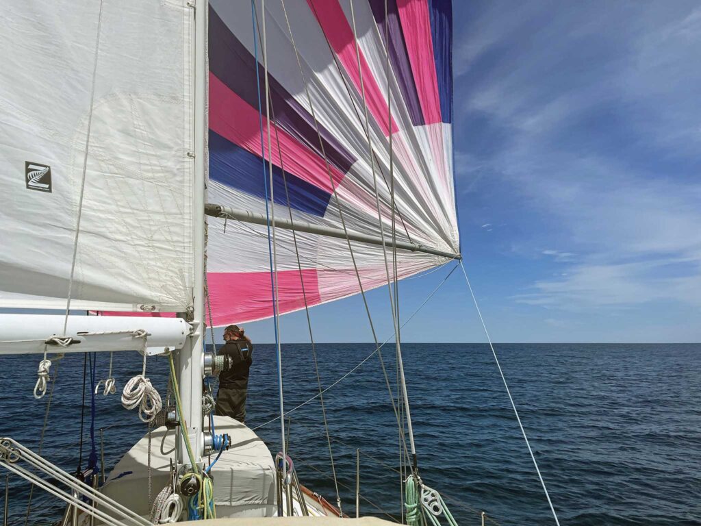
A straight line and constant compass course to our destination in Maine would put us on a run, so we discussed how dead downwind sailing compares to a broad reach. For longer passages, comfort plays a crucial role. Sailing directly downwind can get a bit rolly—when the sails are set all the way out, they don’t provide any wind resistance as the boat rocks, allowing for even more movement. In contrast, a broad reach feels steadier and offers better steerage control.
We considered the mileage difference between sticking to the rhumb line and zig-zagging downwind, ultimately deciding to start with a broad reach to ease into the overnight passage. This point of sail keeps the crew snug in their bunks instead of being tossed around by the rolling waves. That stability lets everyone catch some quality Z’s. Plus, with less chance of an accidental jibe, the captain can finally relax and grab a bit of sleep too. It’s a win-win for the whole crew as we sail through the night. Plus, the route took us closer to Stellwagen Bank, where we hoped to spot some whales—and we did.
At noon, we started the watch rotation again with new watch partners. With a short passage we could manage four hours on, four hours off for the duration.
As we approached Cape Ann, we executed a jibe to make an offing—getting ourselves further away from the hazards of land as night settled in. This maneuver also put us on a direct course for Rockland, with the wind filling our sails nicely from the starboard quarter.
The next morning we set the spinnaker and ran downwind towards Monhegan. The excitement was high! We had enough wind to keep it full and were making 6 knots in the right direction. These are the mornings at sea we all dream of, with coffee and fresh baked muffins in hand.
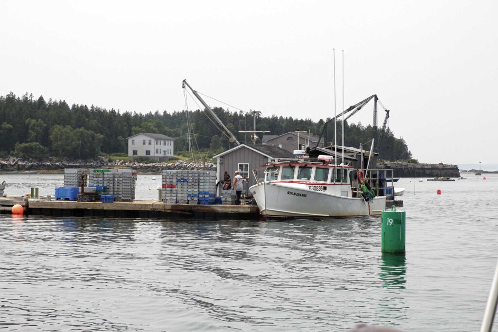
The distant hum of engines signaled lobster boats ahead. Typically, lobstermen work closer to shore during the summer months as lobsters migrate to shallow waters to lay their eggs. However, many boats still set traps farther out, anywhere from 20 to 30 miles offshore. The common practice is to steam out to the deepest traps in the morning and then work their way back toward shallower waters, hauling in two, three, or four traps at a time.
It’s this sight of trap buoys and the sound of engines signal that we’re nearing Maine. It was time to keep our focus sharp. All hands on deck. We aimed to arrive in “lobster pot land” during daylight hours and, in fact, we hove-to a few times to wait for sunrise before entering these lobster pot-infested waters.
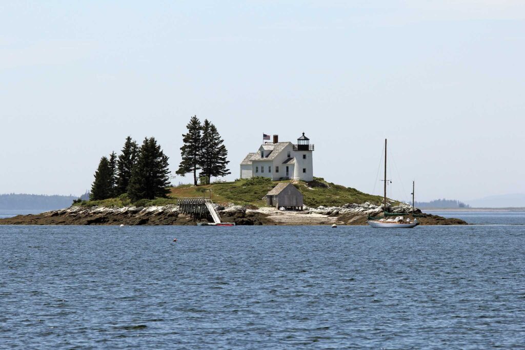
The Maine coast is stunning and unmistakable. There are so many idyllic anchorages, breathtaking hikes, and quaint towns to visit. You’ll need a few months, at least, to explore sufficiently. Despite the challenges—ledges, lobster pots, fog, and tidal currents, Maine’s coast is worth the trip, year after year.
A high tide in the afternoon meant that we had a favorable current entering Penobscot Bay in the morning. We sailed up The Mussel Ridge Channel—a narrow channel between islands that is full of hidden rocks and shoals. It’s fairly well marked with navigation buoys and on a clear day is straightforward, as long as you are paying close attention.
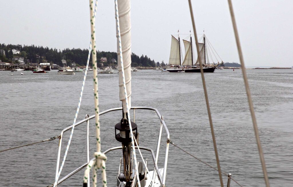
Rockland is a perfect entrance town for sailors. The large anchorage is well protected by the mile-long scenic breakwater and C-shaped natural harbor. The town has plenty of docks and moorings, fuel, water, pump out, and a marine chandlery. Rockland is a working waterfront with a construction tug and barge company, a seaweed processing plant, a USCG station, a ferry terminal, six windjammers, and of course plenty of fishing vessels.
We tied up at the town dock, walked through the quaint downtown, and had a lobster dinner at Claws. We recalled the passage, discussing both the high points and the challenges we faced. We navigated a cold front, dealt with weather delays, timed the currents, and made an overnight crossing while standing watch. Despite the hasty departure, it was a perfect run to Maine. This trip served as an ideal preparation for many of the crew who are sailing across the Atlantic with Morse Alpha Expeditions later this year. The feeling of accomplishment was unanimous, and all aboard felt capable and proud, already making plans for next summer’s journeys.
This article was originally published in the March 2026 issue.


