Well, this was a conundrum. We’d only been hiking for an hour in Seal Bay on the east side of Vinalhaven in Maine. A blaze mark had led us from the shore across broad backs of granite dotted with lichen and moss to a 2-mile trail that climbed a steep hillside through firs and birches. We passed a sign with a map telling us the small preserve we were about to enter had been donated by local landowner Sherry Huber to the Maine Coast Heritage Trust. The woods smelled fresh after rain.
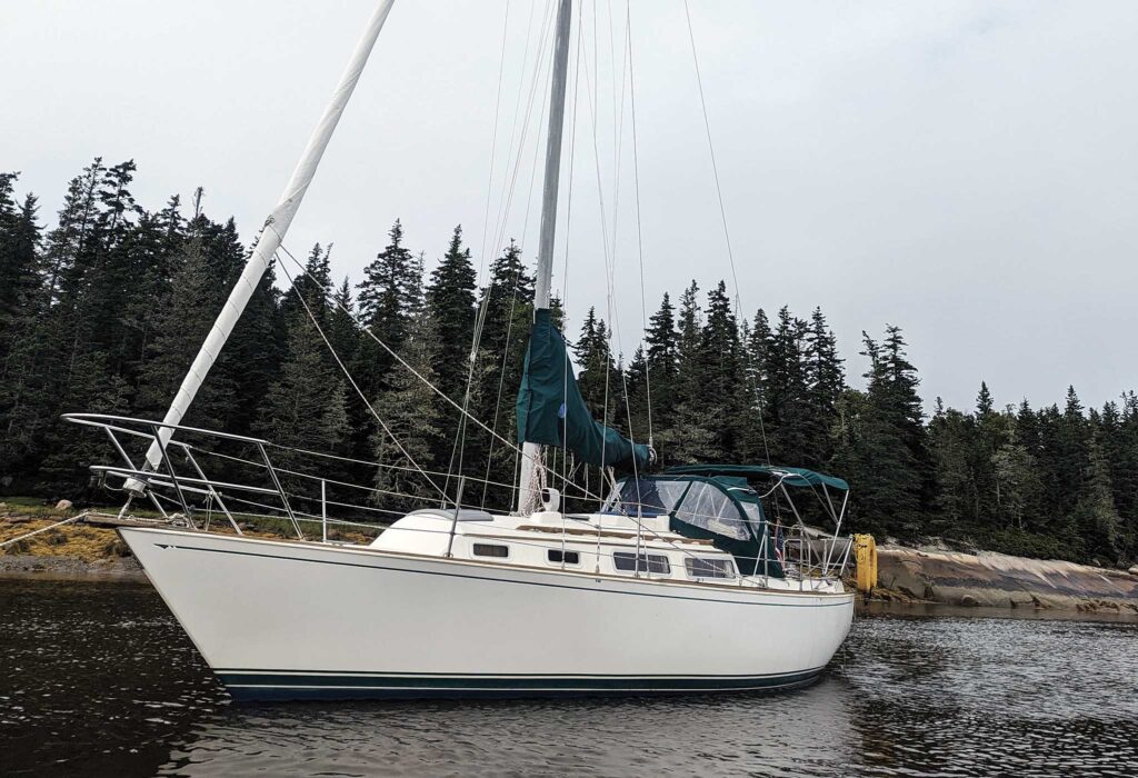
It had been a lovely leg stretch—just what we needed as a little break from our Sabre 30, Ora Kali—but when we descended, a wide mudflat devoid of puddles stretched between our dinghy, open water, and our boat resting peacefully at anchor some 400 yards away. We waited an hour and a half for the tide to return. By the time the sun was descending towards the trees across the way and the air was starting to lose its heat, a rill of water finally reached the plank we laid across the mud to bridge the last gap, and we got home in time to watch the full moon rise.
Such are the risks one encounters when trying to take advantage of the many hiking trails and paths that Maine’s islands have to offer the summer sailor, particularly when cruising in a keelboat. But they’re more than worth it.
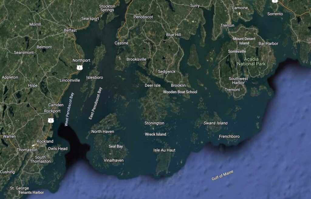
The coast of Maine is the longest in the U.S., not because of straight-line distance but because of its sheer complicatedness. The coast where I live is a mass of bays and inlets, making for long peninsulas whose tips are as accessible by boat as by land transportation. Early houses in my town were all built facing the sea, because that’s how everything came in and went out.
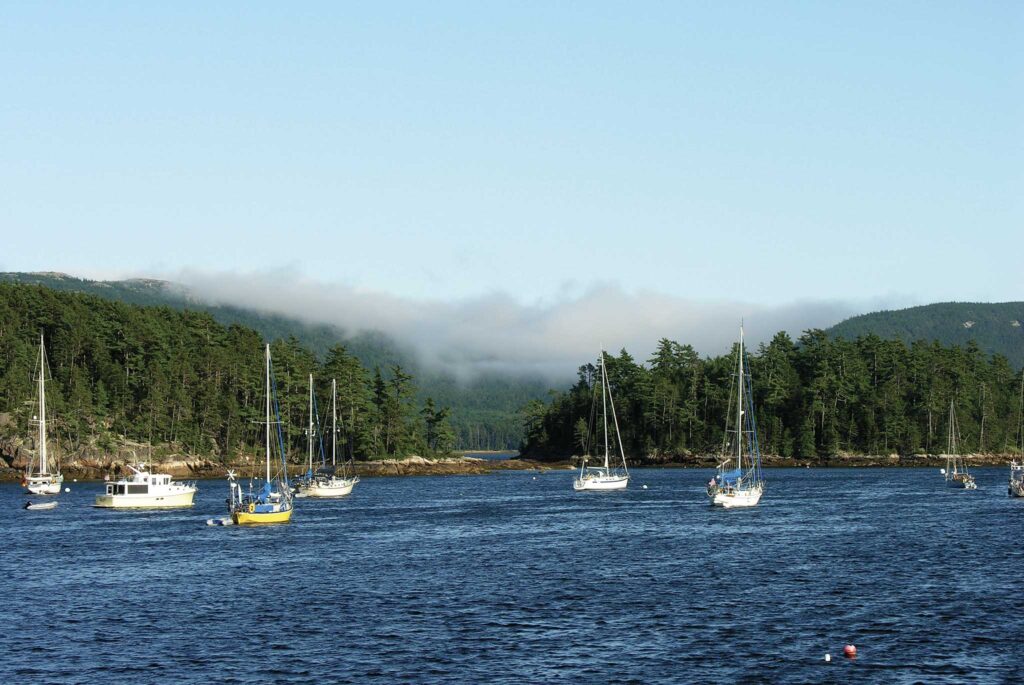
As the map shows, it’s also an island paradise. Islands feel like domains of the sea and seafarers. They call to passing sailors to come and visit. More than 4,600 dot Maine’s coast. Of these, 1,846 are registered to private owners, 1,322 are under state custody, and of 170 inhabited islands, only 15 unbridged ones have year-round populations. Many look more like large rocks than places to land.
That’s a lot of islands to explore. How does one winnow them down to a usable list?
The winter before our first coastal cruise, a copy of the Maine Island Trail Guide landed in my mailbox. I joined the Maine Island Trail Association without realizing that this 350-plus-page spiral bound book was a perk. Co-founder Dave Getchell’s vision of a waterway for small boats with overnight stops, similar to the Appalachian Trail for hikers, came to him when he explored Maine’s state-owned islands in a tin boat with an outboard motor. MITA doesn’t own land itself; it partners with nonprofit, federal, state, and municipal owners, land trusts, and private owners and encourages volunteer stewardship of Maine’s wild islands by the people who visit them.
It seemed like a fantastic resource—and it is, if you’re traveling in a small, shallow-draft boat or kayak. But my enthusiasm for the MITA guide ebbed when I realized that for cruising sailors with deep keels it’s of limited use. Nevertheless, it was a starting point, not least because it put our summer cruising in a different light.
Leaving from my hometown of Sorrento, which lies across Frenchman Bay from Bar Harbor and the northeast tip of Mount Desert Island, it’s only 55 nautical miles as the crow flies to Tenants Harbor, what we set as our turnaround point for the cruise. But it crosses three major bays, and Penobscot, the largest, by itself has more than 200 islands. Why not use it as an opportunity to sail to hike?
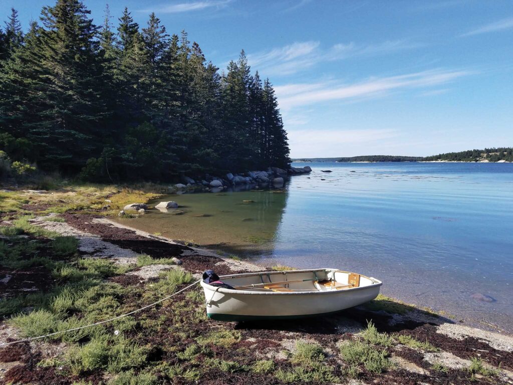
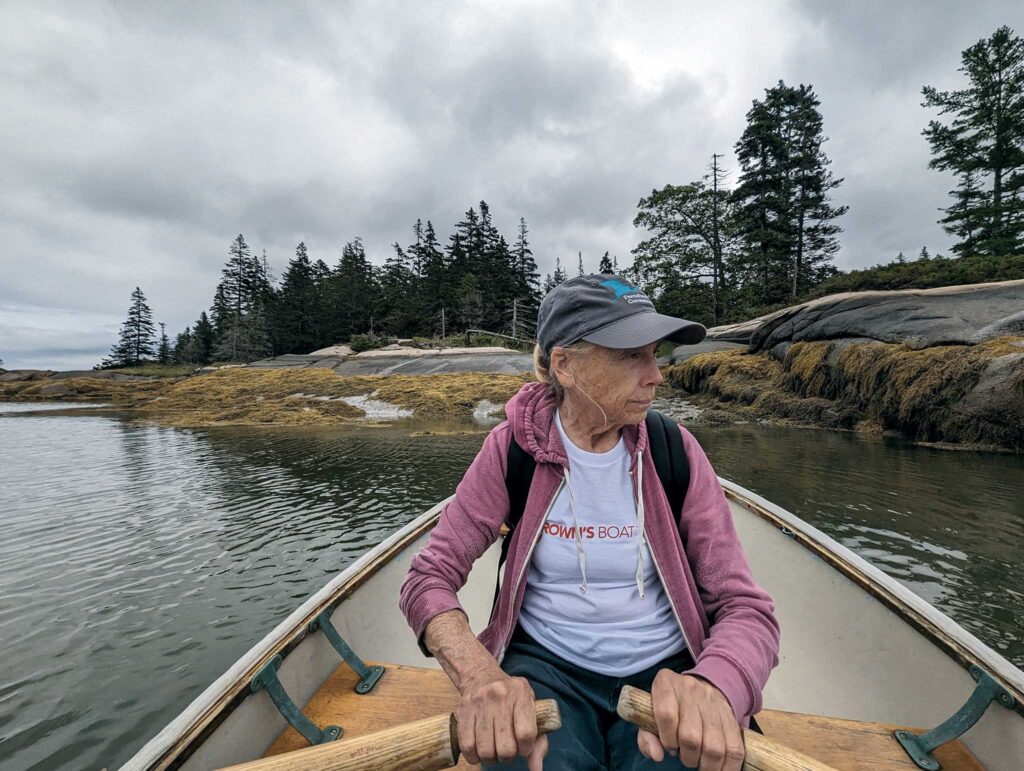
The dinghy rests on the beach at Wreck Island. Photo by Ann Hoffner
What I learned on this journey is that even while you can do plenty of research ahead of time about where to find prime island hiking while cruising this part of Maine, the reality is there is no single good source of information, and many times we simply stumbled into a path that wasn’t on anyone’s map. In other words, you need to keep your eyes peeled, your mind open, and your cruising schedule flexible.
Our first experience with this came after we’d already made several hops from our home mooring and landed in Vinalhaven’s Fox Island Thorofare among seals and dolphins, eventually grabbing a Brown’s Boatyard mooring at the edge of the North Haven fleet. It had been three days of short—if sometimes tricky—passages to get here, and after three nights on the boat we were ready to get off.
We rowed our dinghy, Mighty Mite, ashore, took showers at the marina, bought high-priced bakery pastries from a bored college kid, and were going to walk off our antsiness among the busy car traffic and narrow roads when we stumbled upon a small nature preserve within walking distance of the dinghy dock called Sage Woods.
From the entrance sign, a faint track climbed gently up a wide grass field. The woods themselves reminded me of the suburban reservation I grew up hiking in, trimmed of much of their undergrowth but cool on a hot summer day. Without a map it was hard to follow the concentric circles of one-and-half miles of groomed trails that led up and down rounded hills, but if we strayed out of the 14 acres of conserved land, we would soon be back on village roads if not in someone’s backyard.
Back on our mooring, I used my cell phone to see if there were other hikes to walk to from our mooring. By researching Sage Woods I happened on the North Haven Conservation Partners website. This website lists the Maine Coast Heritage Trust as a partner. MCHT owns more than 120 preserves that are free and open to the public, including Huber Preserve in Seal Bay, and in 1995 it established the Maine Land Trust Network, a service bureau for Maine’s 80 land trusts which together preserve over 2,500 miles of publicly accessible trails.
So, I switched over to the MLTN website, where I could reach another selection of preserves and their websites. (This didn’t include a small preserve we hiked later along an estuary in Tenants Harbor, because it is managed by the Town of St. George Conservation Committee.) The only nearby preserve I found, run by the NHCP, Calderwood Island, has a mile-long network of trails, but we would have to anchor off, and that corner of North Haven is wide open to the northeast and didn’t look promising for the next couple days. By now thoroughly sick of navigating acronyms and hunting on the internet, I decided it was time to sail to hike, not surf the web.
East from Vinalhaven is a celebrated archipelago of 50 mostly uninhabited islands known as Merchant Row. To overnight on Ora Kali we chose Wreck Island, owned by the Deer Isle-based Island Heritage Trust and listed in the MITA guide. It was Labor Day weekend and clearly we claimed the site before the weekend boaters from Stonington got their act together, because a steady stream of them passed the mouth, looked in, and moved on while we sat snugly surveying the tiny U-shaped cove that we had worked our way into.
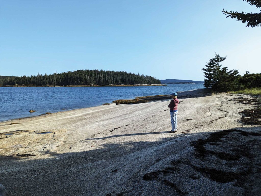
In the 1800s, Wreck Island was named Barter after four families that fished and farmed there. After the last of the Barters left, the island was overgrown. Today a rustic trail loops around it, leading out to an unusual beach of tide-smoothed ledge on the east end where we signed a visitors’ book and I stood glorying in the sun. Downeast Maine is at its best in September. Much of the trail looks like an animal track winding up and down uneven ground, and Tom and I lost its trace in an overgrown meadow and had to fight through thigh-high bushes. If this had been spring, we might have startled nesting birds or worried about ticks.
From the island’s south side several spur trails led out to pristine pocket beaches. Sparkling views of boats underway in the surrounding channels reinforced our sense of having this island to ourselves. The feeling makes me wonder whether part of the appeal is harkening back to our days in the South Pacific, when we tromped over islands with a sense of entitlement. In the late afternoon the island smelled of ferns, and in the morning before we left, a racoon came down to fish from rocks not far off Ora Kali’s port side.
The WoodenBoat School in Brooklin, Maine, is at the bottom end of one of our coast’s long peninsulas 30 miles from the coastal highway. It is an iconic place where people who love to build fine wooden boats come to teach those who would like to learn. Summer courses book out as soon as they open up.
We had the advantage of being able to sail there, though fog plagued us right up to the time we anchored in their fleet of classic boats. Next morning we tied Mighty Mite among lovingly crafted small boats at the dinghy dock, slung on our backpacks and walked up to the road that wound through the school’s property. I found a few apples on accessible limbs of old trees that looked ghostly in the grey, then hurried after Tom who hadn’t slowed down. We were bound for the Brooklin General Store one-and-a-half miles away hoping to get a few canned goods and maybe bananas or fresh pastries to liven up our food stores.
We exited the school grounds leaving the fog behind and walking into a beautiful early September day. Just before Great Cove Drive joined the main road, I noticed a cut into the woods and veered to check it out. A nearby tree sported a big blaze, and a notice read: “Welcome Walkers. Walking on our land is at your own risk and your respect for our woods and its inhabitants is appreciated.” It was signed by Richard Hero and gave a local phone number.
“Shall we try it?” I gestured.
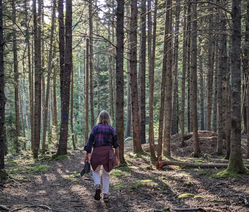
I snapped a photo of Tom before he headed in. It’s a young forest, with well-spaced straight tree trunks. The season had progressed enough that yellow leaves scattered on the forest floor under the occasional deciduous tree and gathered in patches of sun positively glowed. The trail was easy until it crossed a classic swampy sink, and we had to jump from tree root to tree root. Lucky I was wearing my sandals as I slipped into shallow water a couple times. The trail dead-ended at a private driveway, and the return looped up to the main road then back to join itself.
Though 94% of Maine’s heavily forested land is in private hands, 10 million acres of working farms and forests are open to the public through voluntary contributions by landowners, like Richard and his wife, Jane Whitney, who according to the Department of Inland Fisheries and Wildlife, over the past 200 years have forged a tradition of neighborliness with residents and visitors that is “found nowhere else in the nation.” The system works if everyone understands and respects the fact that people who want to use private land for recreation must ask permission.
The seas belong to everyone, but as soon as I moor or anchor in a harbor, I become a visitor, dependent on public or private hospitality to set foot on shore. Mr Hero’s welcome sign gave that permission and was true gold for the sailor/hiker. So far, I have not found his trail on the internet.
All good summer cruises by definition come to an end. For Tom and me on Ora Kali, this meant reentering Frenchman Bay. As is our habit, we stopped in Southwest Harbor on Mount Desert Island and rented a mooring in the crowded harbor. MDI, as it is known to locals, is the home of Acadia National Park, which has some of the best hiking on the East Coast. Twenty-six granite mountains covered in forest rise up literally from the sea to Cadillac Mountain, at 1,530 feet the first place the rising sun’s rays touch the East Coast. By the time we arrive we are usually eager to end our cruise, but if we so choose, we could take the Island Explorer bus from Southwest Harbor to one of the many park trailheads. During popular summer months trailhead parking lots fill up early, and the bus is a great way to get off for a day’s hike.
Usually, we opt for a very last night at Bean Island. Though only a mile-and-a-half from the entrance to Sorrento Harbor, and with houses on the shores to either side, Bean is an uninhabited wild spot. When I was a child, the owners ran sheep here, but in 1975 it was put under National Parks conservation easement and in 2016 passed to the Frenchman Bay Conservancy.
On this early autumn evening, low tide uncovered the rocks to the east, the local seals gathered to roar and howl, the full moon was visible, and the smell of fir trees wafted down as the island lost its daytime heat. I felt like I was back in the wilderness of Seal Bay. A wooden signboard at the top of the beach showed a trail looping around the island, but a close look revealed that a third of it is actually a clamber over the rocky shore. Lobster floats marked where the foot path should head back into the trees; we regained it after a short bushwack over springy needle beds through a mixed conifer forest on the bay side. A couple of twisted boat wrecks in trees brought down by recent winter storms showed the power of the sea. The views across Frenchman Bay to Mount Desert Island from here are spectacular.
It was a quick trip to our mooring in Sorrento, and since we live just a half-mile from the harbor, one last walk home.
Internet research can lead to finding hidden gems, but from the cockpit of a boat, it is a frustrating and limited way to plan. A waterway trail for keelboaters eager to stretch their legs would take tons of research combing through local knowledge, cruising guides, information on Maine’s extensive public trails, and exploration by boat and foot. No guide or organization keeps track of our coast. Perhaps this is a sailing dream for the long Maine winters when the sun goes down at 3 p.m.
Or, perhaps it’s just an extended invitation to ditch the digital and explore by sailboat, enjoying the unexpected hiking treasures you will undoubtedly find.
Acadia National Park and Isle au Haut
There are a variety of ways for sailors to explore the hiking wonderland that is Acadia National Park, but one of the best is to navigate up Somes Sound, a fjord-like bay that slices deep into the mountainous island, and drop the hook at the northern end near the picturesque village of Somesville. From here, it’s a short trip into a dinghy dock and then a walk to the main road, where you can pick up a ride on the free Island Explorer shuttle bus, which travels throughout the park. Entering the park on foot requires a $20 per person pass if you are over 16 (it’s good for seven days), which you can get at several of the park’s campgrounds and headquarters in Bar Harbor (more info on this at nps.gov/acad/). Acadia offers more than 150 miles of hiking trails, ranging from simple, flat paths along beaches and through woods to strenuous technical climbs up the granite. A terrific guide to help with planning, should you choose to add this to your summer sailing, is the Falcon Guide Hiking Acadia National Park, by Dolores Kong and Dan Ring.
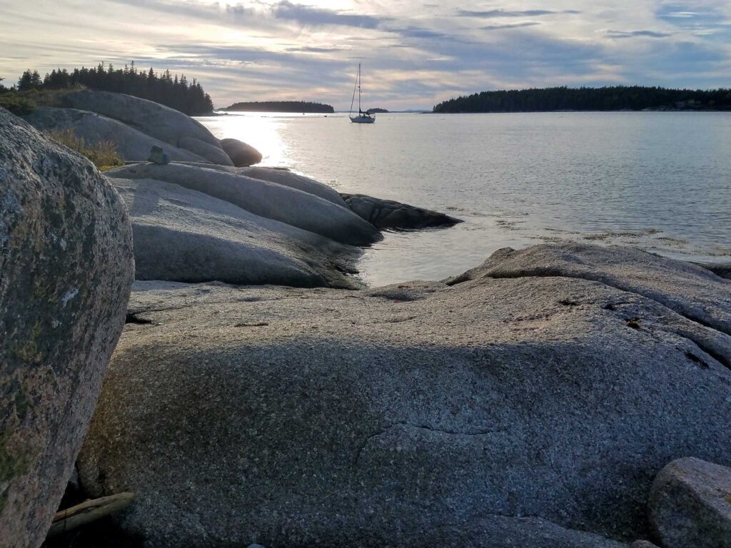
As sailors, we’re also privileged enough to have ideal access to another of Acadia’s treasures, Isle au Haut. Located offshore east of Vinalhaven and southwest of MDI, this island “offers some of the wildest hiking in Acadia,” according to the Falcon Guide. Paths are packed into 18 miles of trails within the park’s boundaries on the southern two-thirds of the island and include forests of thick pine, high meadows of low-bush blueberries (in season), and 100-foot-high cliffs. What makes this place even more special is its remoteness; it’s entirely possible to have a trail to yourself even at the height of summer tourist season, simply because the island isn’t that easy to get to. A few moorings are available in the Isle au Haut thoroughfare between Isle au Haut and Kimball Island. A great resource for mooring and anchoring here is through the Cruising Club of America’s Maine Guide at guides.cruisingclub.org.
—Wendy Mitman Clarke
June/July 2025